Godfrey Lumber Railroad
Click on the map on the left (below) first to establish your bearings.
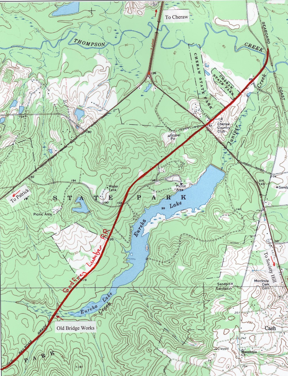
The second map shows the origin of the rail as a spur of the SCL originating just on the Cheraw side of where the SCL crosses Thompson Creek. It then follows Cash Rd. and bisects the State Park. Here's where it gets interesting.....the RR crosses the head of Lake Eureka and continues to Campbell Lake, etc. This is musing to me because I have been told since I moved to Cheraw (29 years ago, this year) by State Park folks that the crossing at the head of the lake was the "old highway #1" that was later moved to its present location when it became the Jefferson Davis highway and was improved. The earthworks and rockwork are still present at the head of the lake and I always thought what was there was too narrow to be a road designed for cars. I believe they are wrong, or maybe US #1 did follow the route AFTER the railroad was abandoned, or else I am very confused....What do you think?
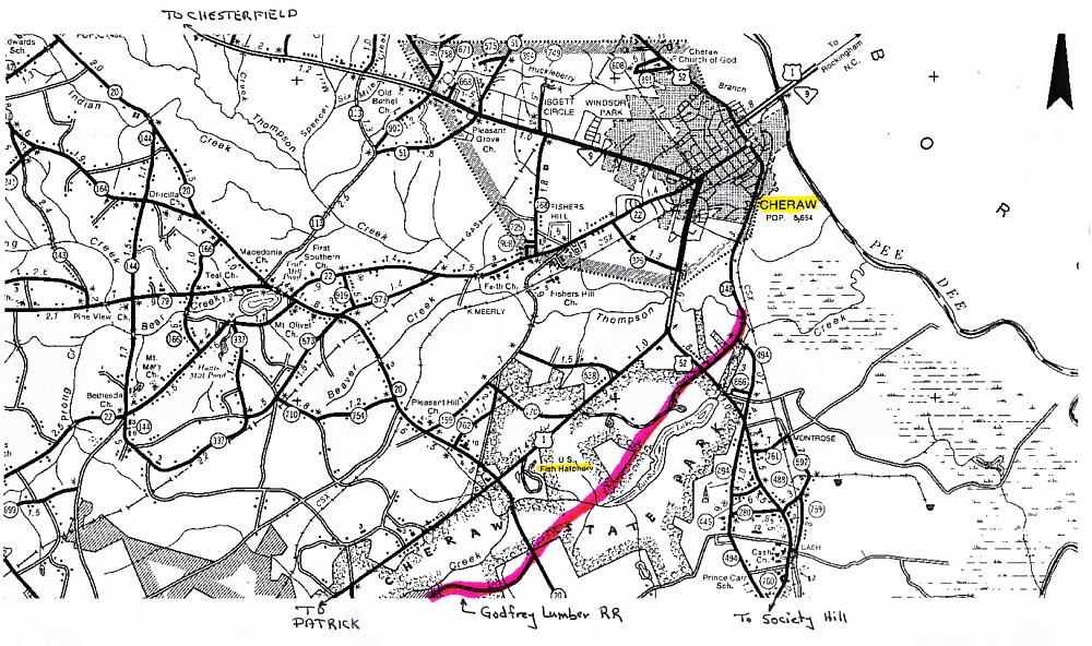
"Cheraw" bearings from a
Chesterfield County map.
route between Cheraw, SC and
Cheraw State Park (section 1).
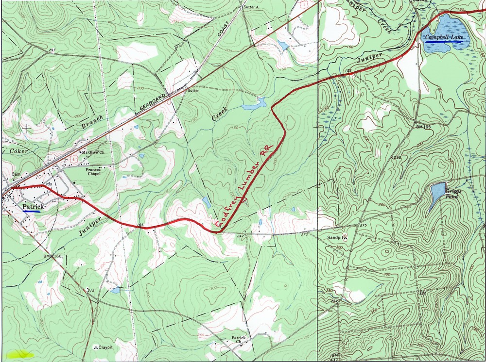
For those of you that are interested, the line ends in downtown Patrick.

Click on the thumbnail to see the
route between the State Park and
Campbell Lake (section 2).
Click on the thumbnail to see the
route between the Campbell Lake and
Patrick, SC (section 3).